
After Confederation in 1867, the new federal government began assuming responsibility for navigational aids. There was a lot of work to do, both in taking over privately maintained navaids and installing new lighthouses, buoys, and day beacons.
Georgian Bay (and the North Channel) got its fair share of attention from the departments of Marine and Fisheries and Public Works. Shipping out of ports like Collingwood, Owen Sound, and Midland increased as rail links were completed. Vessels were running to ports as distant as Thunder Bay and Duluth on western Lake Superior as settlement and rail construction pressed westward, and Chicago was an important destination as well. As well, most of Manitoulin Island (except unceded Wikwemikong) had been opened to settlement through the controversial Treaty 94, which among other things created the port of Little Current (from which Indigenous people were barred from settling).
Lighthouses were few and far between on Georgian Bay. There were no official navaids north of Christian Island on the eastern or northern shore, other than the light and range established at Little Current in 1866. The government could not afford to build more of the “Imperial” round stone lighthouses of the 1850s such as Nottawasaga Light, off Collingwood, and Christian Island Light. Instead, it chose to build much more cheaply, in wood, and prioritize spending on light optics.
The first light marking the approaches to Parry Sound, where a lumber town was established in 1869, was placed at what is now called Old Tower Island, at the south end of the Mink Islands, in 1871. Over the next decade, many new lights appeared on Georgian Bay, and Parry Sound’s approaches were reworked. I’ll have more to say about that in another post, but the Parry Sound light was relocated to its present location, Red Rock, as a wood structure, in 1882, after a tender was issued in 1878.

McKenzie’s Wharf, at Presqu’ile north of Owen Sound, where steamers took on wood for fuel, got a light in 1873. Understanding that the feds would subsidize the operation of a light, the Magnettawan Lumber Company had gone ahead and built one at Byng Inlet in 1870. Ottawa had not approved the design, but agreed to help foot the bill while it planned a proper replacement. It assumed full responsibility for the light in 1875, while paying the lumber company to operate it. A new, official light, at Geraux Island (which remains the lighthouse site at Byng Inlet), was planned in 1880. The French River eastern outlet and the nearby Bustard Islands got their range lights and navigation aids in 1875. The Bustards were emerging as a fishing station; the French River outlet was about to sprout a lumber town and also became a marshalling point for crews working on the transcontinental railway. Michael’s Bay on southern Manitoulin Island got its light in 1875. Meaford’s light was lit in 1876.
At the southeastern end of Georgian Bay, the government prepared for an anticipated boom in shipping that railway construction would bring. The boom didn’t quite go as planned because the Midland Railway ran out of funds in the Long Depression of the 1870s and didn’t complete the last section of its line from Waubaushene through Victoria Harbour to Midland until about 1878, and Penetanguishene didn’t get a spur line of the Northern Railway from Barrie until 1879. But the first lights were installed regardless.
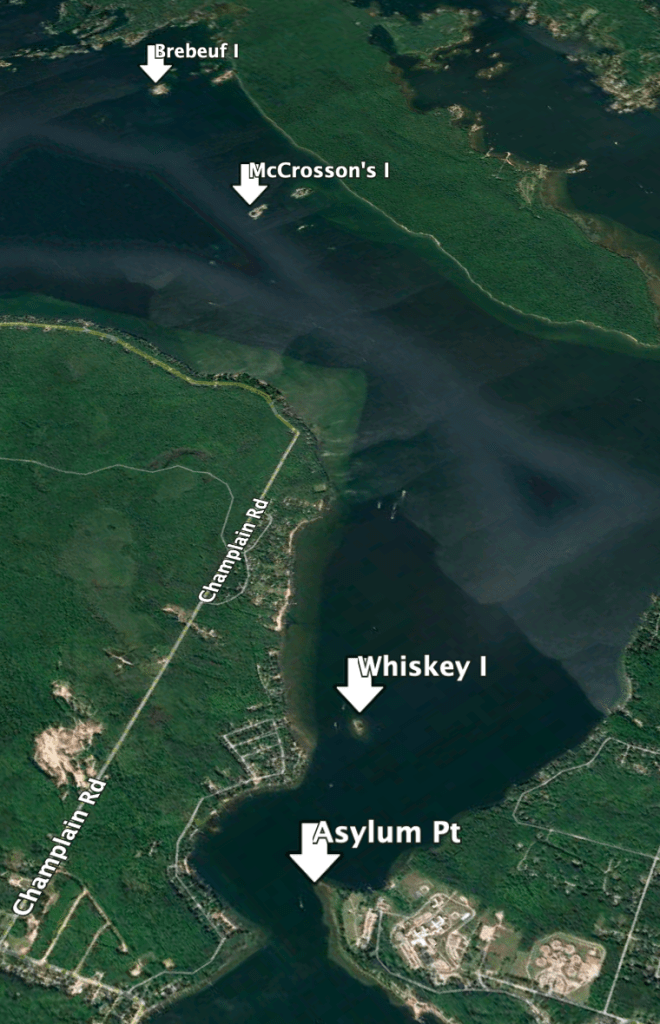
Boaters who enter Severn Sound today know the Brébeuf Island light and rear range on the west side of Beausoleil Island, which guides vessels in from the south end of Christian Island. But the first light locally was about a mile and a quarter south of there, on what is known today as McCrosson’s Island in the Gin Rock Islands. It went into service in 1875, and a light was added at Asylum Point in the approaches to Penetanguishene Harbour the following year. A light at Whiskey Island in outer Penetanguishene harbour was installed in 1883.
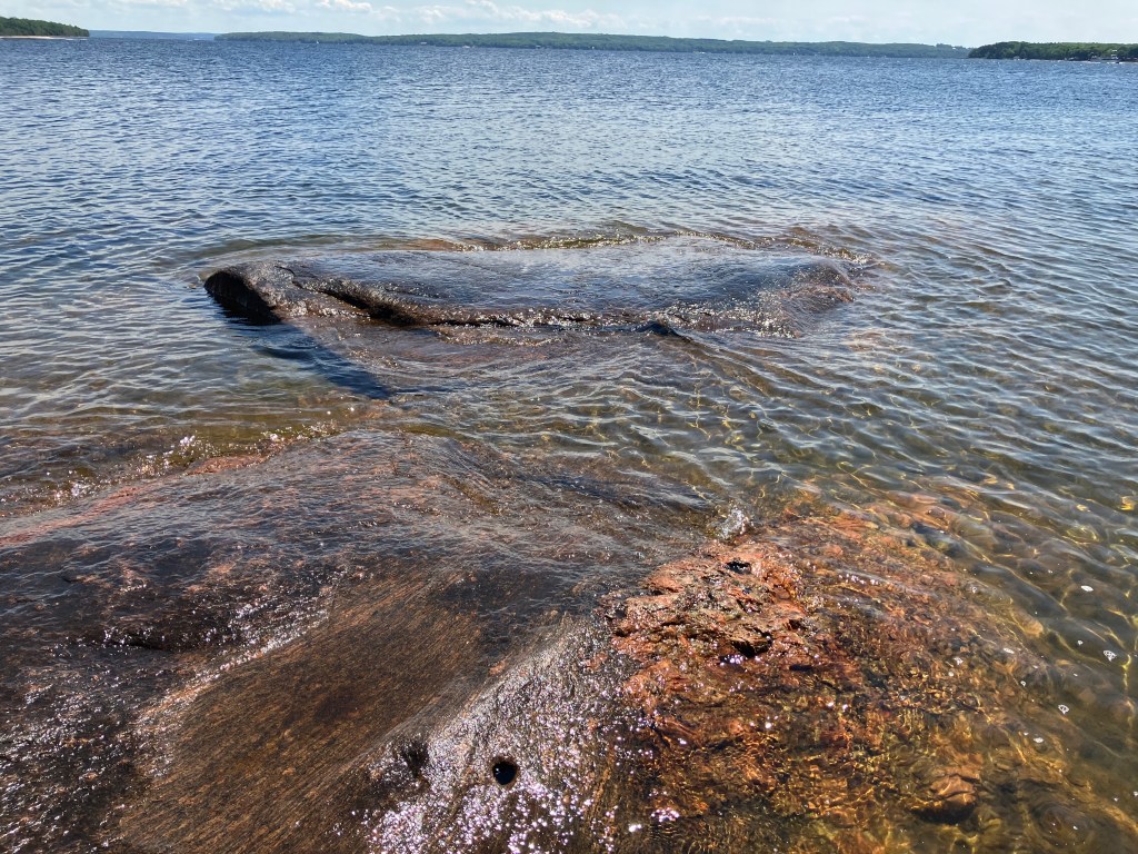
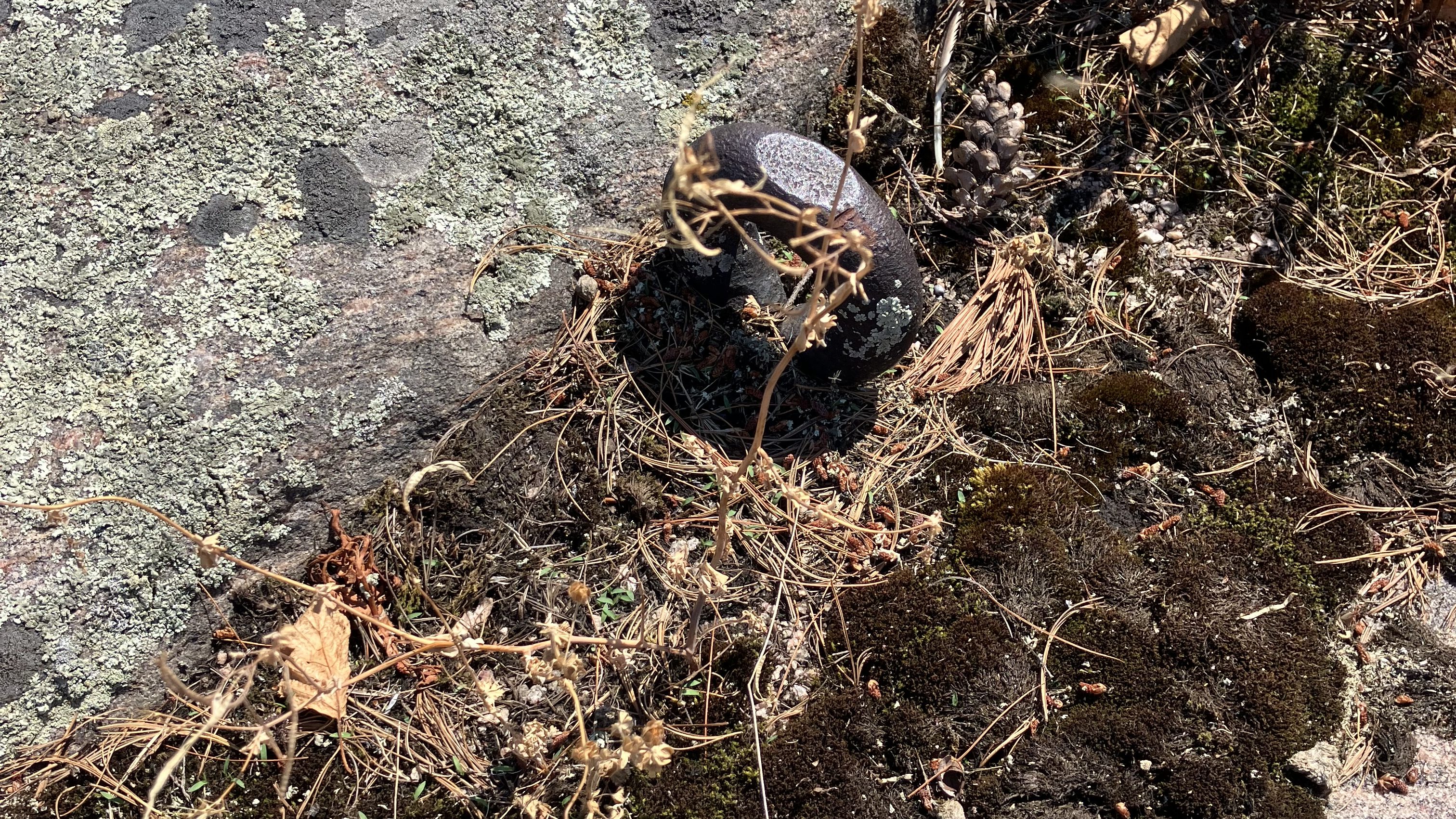
The Gin Rock Islands are now part of Georgian Bay Islands National Park. I’ve visited them a fair number of times, and on a visit last summer I tried to see if there was any trace of the lighthouse that once stood there. I imagine that the white square wood tower with a light 36 feet above the water, which included a home for the first keeper, Israel Mundy, was built somewhere on the high, smooth stone of the small island’s west side, but I couldn’t find a hint of its existence. The only clues to the island’s past were on the island’s south side, where I found a hole drilled in the rock by the shore and my sharp-eyed spouse spotted a large iron ring embedded in the rock further inshore. I imagine both were used to secure the facility’s dock.