
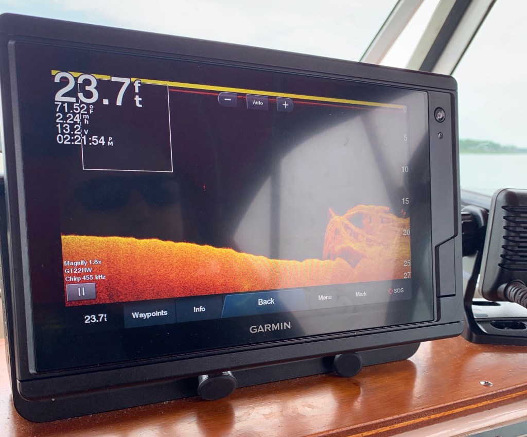
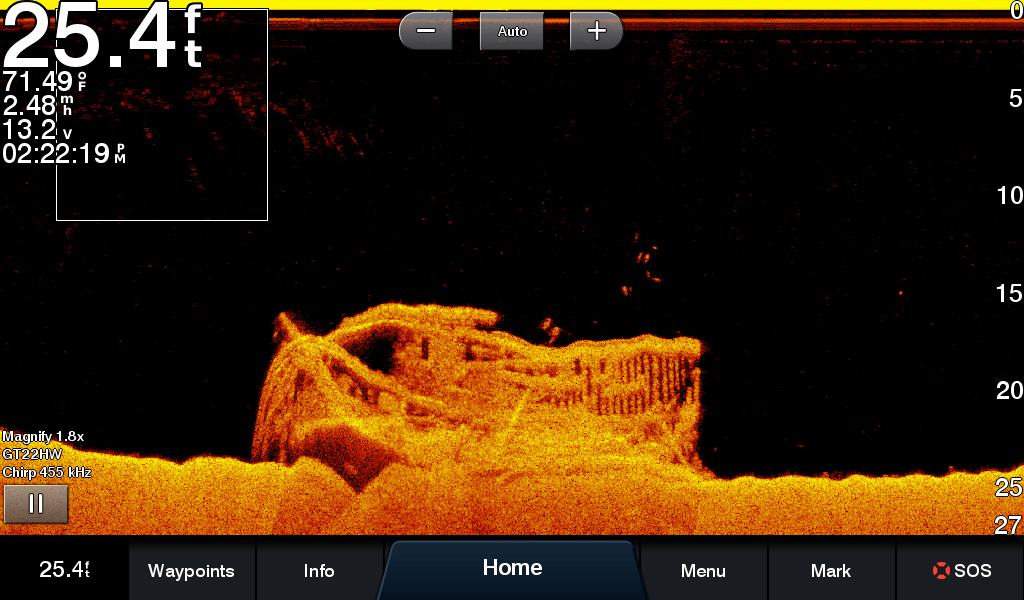
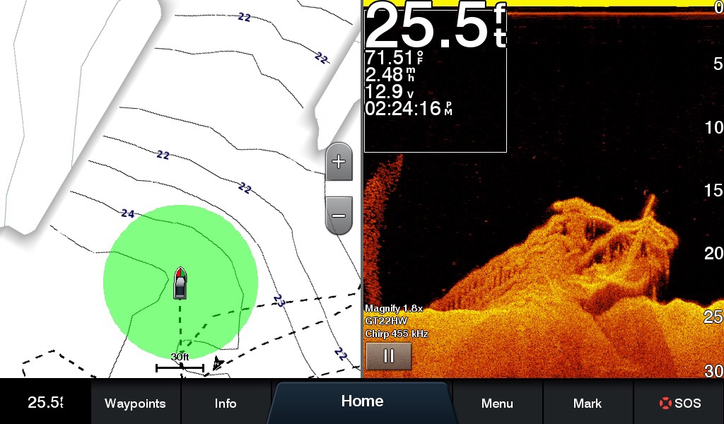
I was back today in the vicinity of where I located the Wawinet on Wednesday. The water was surprisingly calm for a Saturday, with minimal boat wake, so I made a couple fresh sonar runs and came up with better images than on the initial day. High-frequency CHIRP sonar can produce remarkably photograph-like imagery. What little waviness appears in these images is due to the boat bobbing in a bit of chop. I have zero doubt that this is the Wawinet, which as I explained in the last post was an 87-foot propellor-driven vessel owned by former NHL player Bert Corbeau. She sank in September 1942 after touching the nearby bank at the south end of Beausoleil Island on a night cruise. Twenty-five of forty-two people aboard were lost, including Corbeau.
