Chart updates are few and far between lately on eastern Georgian Bay, but today Canadian Coast Guard issued a Notices to Mariners (NOTMAR) correction for sheet 1 of 2202 and the corresponding area of 2241 that adds a wreck. There was a NAVWARN for this wreck last summer, but now it’s officially part of the undersea landscape.
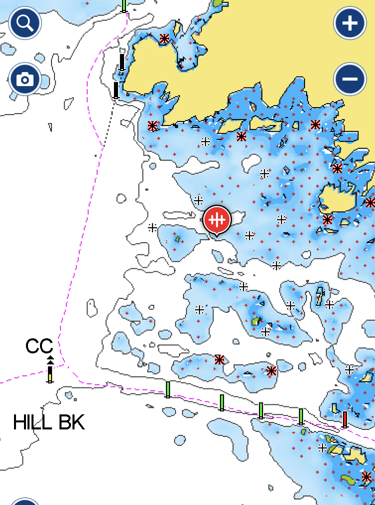
I have no information about the nature of the wreck. It’s in shallow water, in behind Jeffery Reef, just east of the run between Moore Point and Hill Bank on the small craft route north of Potato Island. It’s described as “wreck, least depth unknown, dangerous to surface navigation,” and is at 44°48′12.0″N 079°47′12.0″W. I’ve marked its location here in Navionics, and have put it on my to-do list of wrecks to inspect.
